My hiking buddy is always teaching me stuff. It is possible to estimate the average winter snow level by observing the lichen level. In the picture below you can see the level of the lichen. This line was at about eight feet.

My hiking buddy is always teaching me stuff. It is possible to estimate the average winter snow level by observing the lichen level. In the picture below you can see the level of the lichen. This line was at about eight feet.
Posted in Uncategorized | Tags: backpacking, camp chair, camping food
This hike started at the Willamette Pass Trailhead for the Pacific Crest Trail.

The hike in was 6 miles with an elevation gain of 1000 feet. The trail is well maintained although some of the signage is bit funky. An alternative starting point would have been Shelter Cove on Odell Lake.
Lakes are numerous along the trail.

Midnight Lake with couple of nice campsites on the west end of the lake and signs of fish but we didn’t stop to fish.

Arrowhead Lake

Lils Lake and our campsite; it was a bit close to the lake, but we had to make the trade-off between using an existing camp or carving a new camp that meets the 100 foot requirement.


Yoran Lake, the blue route on the map is the way that we got to the lake. The trail is bit sketchy in spots. There is a more direct route to this lake from Lake Odell.
The next day we left our packs at Lils Lake and hiked up to the saddle between Yoran Peak and Diamond Peak. The hike was well worth it affording great views of the peaks as well as a nice look back towards Odell Lake with Willamette Pass Ski area on the slope beyond. This section is shown as dashed black on the map.

Diamond Peak

Yoran Peak

In addition to the views we also got another treat, huckleberries.

Posted in Uncategorized
A quick update on the status of the Corvallis to Coast Trail. The C2C partnership has been granted a Special Use permit from the Forest Service to construct and maintain the eastern portion of the trail, this section runs from Corvallis to the Big Elk Campground near Harlan. The C2C hopes to have a formal opening of this section in the summer of 2016.
Posted in Uncategorized
Road access report: The road from highway 22 to Breitenbush Lake has not been maintained in several years and many sections are very rough. I would only recommend driving the road in a high clearance vehicle, when it was dry 4 WD was not necessary.
Our original plan had been to leave a car at the Whitewater Trailhead and then drive to Breitenbush Lake and hike down from there. This would have been about 11 miles, with most of the hike flat or downhill. Because of the poor condition of the road we decided to drive back to Whitewater and do a out and back trip. This hike was about 12 miles with a steady uphill grade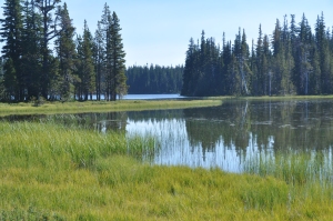 on the way in.
Breitenbush Lake is very pretty and when we were there a number of groups were staying at the camp ground. Our time did not allow us the time to do much exploring, there are a number of tribal buildings in the area.
The Whitewater Trailhead is easily accessible. If you don’t have an annual pass there is a $5 fee that can be paid at the trailhead.

The views of Mt Jefferson and the wildflowers make the hike worth it.


The park itself is a heavy use area, but there is plenty of area to spread out in.

Our furthest point in the park was Russell Lake. This is a very pretty lake and I would expect that there are several campsites around the lake.
Posted in Uncategorized | Tags: Hike, Mt Jefferson, PCT
I tried a new lunch option for my most recent backpacking trip.

I premixed honey and peanut butter in a refillable squeeze bottle, for the cracker I like, crispbread. Crispbread is more durable than other options I have tried in the past and it has solid texture and flavor.
To make life easier I place a plastic knife in the bag with the crispbread and I did put the squeeze bottle in its own bag, I had heard too many horror stories about leaking bottles.
I did find that the chunky style peanut butter is a bit too thick to easily squeeze out of the tube. Even with the difficulty I will be adding this to my food list for future trips.
Posted in Hiking Food | Tags: Hiking Food
Trail Head: Park Meadow Trail Head, this is near Three Creeks Lake
Distance: 6 miles one way
Golden Lake is real gem, unfortunately it has been discovered. The hike in can start from either the Three Creek Lake area or the Green Lakes Trail. Our hike started at the Park Meadow Trail in the Three Creek Lake area.
The first couple of miles climbs through an area hit by the Pole Creek forest fire. The fire was very intense in this area so the vegetation is not really starting to return. The destruction does open the up the views of the mountains.

Park Meadow
Next up is Park Meadow. The meadow or should I say meadows spread over a several mile area. There are spectacular views and plenty of wildflowers. We didn’t venture off the main train but there are evidently many nice camping spots in the area. Some that we talked with use this as a base camp for exploring the area.
After the meadow the trail climbs rather steeply for about a mile. Follow the trail signs towards Green Lakes. The early trail descriptions say to watch for a rock cairn. This was gone, we found instead well used trail to the left (coming from Park Meadow).
There are several camp spots in the trees that surround the lake. We camped to right on the edge of the meadow in a group of trees. Other spots are two the left on the hill or across the outlet. Keep in mind that fires are prohibited at all times at Golden Lake. Unfortunately there were plenty of signs that some people don’t seem to think that it applies to them.

The lake is worth the hike. The setting with the lake, meadows and mountains is breathtaking.

Brokentop

Middle and North Sister

South Sister
We fished the lake and did catch a couple of small brook trout.
There is a trail that heads up towards Brokentop that follows the water fall that takes one to a set of tarns. These small ponds also have a couple of nice camp spots and could be a good alternative if Golden Lake is over populated.


If planning a trip to Golden Lake I would encourage going mid week. Some of the people that we met were circumnavigating Brokentop, or they were on a loop that went around the Three Sisters.
Posted in Hike | Tags: Brokentop, Golden Lake, Hike, Lakes, Mountains, Three Sisters
Don’t be fooled by the sign at the Trail head, the distance to the summit is 6 miles. What they don’t say is that it is also one mile up. If you want to climb a mountain this is a strenuous but non-technical climb.

We started at the Devil’s Lake Trail head at 6 AM. If I were to do this again I would start earlier, one person we talked with had started at 4. Once above tree line the trail is very exposed and therefore could get very hot. I was a bit surprised at how many people were making the climb. On a midweek day we saw 30-40 other people.
The hike to the overlook for Moraine Lake was mostly in the forest and is continuously uphill. This 1 ¾ mile stretch is a good test for the rest of the climb, if you have trouble with this section I would not recommend going much further. You could make a couple of nice loops here, one that we did not try is down the trail to Wickiup Plain and is about 3 ½ miles to the parking area.


This is Mortaine Lake and the reports that we got were that the water was very cold still, probably because it is filled from snow melt.
We hiked in Mid July and there were many stretches of the trail that were still snow covered. Traversing them was not a problem, but it did hide the trail making it hard to know for sure where to go.
The climb got progressively steeper and we moved from firm pumice sand to loose pumice and stones.

Along the way are regular signs of previous climbers. The views do get progressively more impressive.

In this photo you can see the trail running diagonally across the mountain from the right to the left, leading to a scramble up to Lewis Glacier just over the ridge in the middle.

In the center of this picture you can see the trail zigzagging up through the red pumice just to the left of the glacier. This section is really steep, but fortunately you are nearing the top.
Aside from the reward of having climbed a mountain the views from the top are spectacular.

This photo is looking south with Mt Batchelor in the foreground, Sparks Lake is the large lake. Because of the haze you can’t really see the distant mountains in this photo but you could see Diamond Peak and Mt Thielsen.

Looking Southeast you down on Brokentop with two of the Green Lakes in the valley.

Looking north you can see the other two sisters, Mt Jefferson behind the North Sister, Mt Washington between them and I believe St Helens in the distance. If you look closely at the upper right you can see a forest fire.

The decent is not nearly as heart beating; however the loose footing makes it strenuous. I would strongly recommend trekking poles as they saved me several times from taking a tumble and you can relieve some of the strain on your legs.
Once down to the car I thought, well been there, done that. Now that the soreness has subsided I am starting the think that this should be an annual event.
Posted in Hike, Interesting Sights | Tags: mountain, South Sister
Length: 7 miles round trip
Elevation Gain: 200 Feet
Trail Surface: Gravel road and hiking trail
The hike to Jawbone Flats is a very unique opportunity to walk into an ancient wilderness with trees that are centuries old. The trail is on a well maintained road that is only used by the operators of the Ancient Forest Center. Within a few hundred feet you feel like you have stepped into a different world.
To get to the trailhead drive to Mehama on highway 22. You will come to a flashing yellow light, this is the North Fork Rd, and you should see the North Fork restaurant on Hwy 22. Turn left/North; the trailhead is at the end of the road, approximately 20 miles. After 14 miles of pavement you will enter the Willamette National Forest and road turns to gravel, you are now on Forest Road 2209. After 1.5-2 miles you will see a turn-off on the right towards Three Pools/Shady Cove. Stay to the left on Forest Road 2209. Continue another 4 miles to the Opal Creek/Jawbone parking area. When you park at the trailhead a Forest Service Parking permit is required. This permit can be purchased at the trailhead for $5 per day if you don’t have an annual permit.
The hike is a very easy day hike although we choose to stay at the Ancient Forest Center for a couple of nights. If you spend the night the center hauls your gear to the cabins in a van so you only need to carry items you want for the hike in.

We spent two nights in one of the houses that are available to rent. The houses are rustic and very comfortable. While there we got to experience a bit of the wilderness experience. Electric power is provided by a Pelton Wheel hydro electric generation system and due to low river flows there were a number of power outages. With a gas stove for cooking and a woodstove for heat these didn’t cause us any problems. Each cabin has a bathroom including a shower with hot water.

The scenic beauty alone is reason enough to visit Opal Creek.


The forests have a wide variety of mushrooms, many of which are very delicious. Warning, if you don’t know for sure what a mushroom is don’t even consider eating them.


The area was the home of both mining and logging operations and as a result there are lots of old relics lying around. It was fun to investigate these and imagine what it was like to live in the area back when it was thriving.

Posted in Hike, Interesting Sights, mushrooms, Uncategorized | Tags: forest, Hike, photographs
A couple of friends and I did a day hike to Marion Lake.

We started at the Marion Lake Trailhead which is off of Highway 22. You are required to have a valid user pass which can be obtained at any Forest Service office. The first portion of the hike shown in red is 2 ¼ miles and climbs approximately 1000 feet. Since the trail quickly enters the Mt Jefferson Wilderness you are required to sign in at the trailhead and get a permit. There is no cost for this; it just provides the Forest Service with information on numbers of people in the wilderness. Our total roundtrip hike was 7 ½ miles and gained 1800 feet.
The trail snakes its way up through an old forest, not sure that it qualifies as old-growth, but there are some very large fir trees. Many of the bigger trees, like the one below show the signs of a forest fire many years ago.
The first lake that you come to is Lake Ann.

Then on to Marion Lake. The lake is sizeable and I have been told that the fishing can be very good, although we didn’t give it a try and couple guys we ran into said the fishing had been slow for them.
This is a shot from the bridge at the outlet which forms Marion Creek.

We decided to continue on up the trail to the Eight Lakes Basin. We ended at Jenny Lake where we had lunch. This section of the trail was 1 ½ miles and added an additional 800 feet of elevation gain.

Marion Lake
On the far side of Jenny Lake can be seen the damage done by the B&B forest fire that occurred in 2003. This was 12 years ago.

Jenny Lake
In early September when we did the hike the Vine Maple was just beginning to turn color.

Posted in Uncategorized

North Sister
I made a second trip to the Collier Glacier, my first trip was made in 2010 and I was interested to see how much the glacier has receded in those three years. This trip rather than camping on a rock pile at the base of the glacier ice we camped at Minnie Scott Springs.
This is a popular camping spot on the west side of the Sisters with good reliable water. The view is not quite the same as being right in the Glacial Moraine, but the view up to the North Sister isn’t bad. Our camp is in the foreground in the trees. The camp is right on the Pacific Crest Trail (PCT) so it does get a fair amount of traffic.
My first reaction when I looked down from the Collier Overlook was that there has been significant change. Part of this was due to the lack of snow on the glacier which meant that the rock debris was more prominent.

Collier Glacier 2013
Below is a picture that I took from the same spot in 2010. You can see that the ice has receded up the hill and many of the rock piles protrude further.

Collier Glacier 2010
As a more concrete indication of how much the ice has receded, during our last trip we bored 3 meter holes down into the ice and inserted three one meter shafts into them. As we worked our way up the glacier we found many of the poles littering the landscape. At one location we were able to find the bottom shaft which meant that 2 meters of ice had melted from that section of the glacier.
This is a photo of a section of the auger we used to drill a new 3 meter hole with the end of the pipe just sticking out. This spot is just below the ice fall and the photo is looking northwest with Mt Washington and Three Finger Jack in the background.

Ice Auger
I am always stuck by the violent past these areas endured with the rocks bent and cracked.

The hills in the background almost look like waves.

As evening began to set the mountains become silhouettes bathed in pink. The mountains left to right (south to north) are Mt Washington, Three Finger Jack and Mt Jefferson.

The sun sets as we head back to our base camp.

Posted in Hikes


